Jim Gerlich
Dublin Core
Title
Jim Gerlich
Subject
Maps
Description
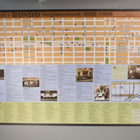
A detailed map of the Rondo Neighborhood between the years of 1920 and 1960, featuring the significant buildings, landmarks, and businesses in the community.
Date
2008
Contributor
Gerlich, Jim.
Collection Items
Map of the old Rondo neighborhood
Map of the buildings, landmarks, businesses, and churches of the Old Rondo neighborhood before the interstate between the years 1920 and 1960, with historical details and photos below. Compilation was completed in 2008.
Interview with Rondo Resident, Jim Gerlich
In the 1950s and 60s, the Department of Transportation in St. Paul, MN bisected a historically Black neighborhood, Rondo, with the construction of I-94, creating an intentional diaspora of the community there. These are the stories of their…

